

Background
Along with the technological innovations that have been taking place in forestry operations, forest measurement assumes an important role by adopting remote sensing, artificial intelligence, and machine learning in data acquisition and processing. Traditionally, these forestry activities are slow and demand a lot of skilled labor, being an expensive survey. However, the use of new tools such as LiDAR (Light Detection and Ranging) presents itself as a promising tool in the quantification of forest resources. By adopting LiDAR embedded in UAVs, commonly named ALS – Airborne Laser Scanning, it is possible to collect a high-density point cloud, process and manage it, increasing accuracy, creating more complex models of forest growth or biomass above the ground modeling, and adding value to traditional forest measurement. It is also possible to generate yield maps, modeling biometric variables such as tree count, height, basal area, and volume. At the same time, a Digital Terrain Model (MDT) and a Digital Surface Model (MDS) are potentially useful for soil classification, soil land usage, harvesting, and logging forest road management.
Methodology
A 2.8-years-old Pinus plantation, 3m x 2m spacing, was used to collect biomass data using a Dji M300 UAV with a Dji P1 Photogrammetry, a Micasense Altum multispectral camera, and the LiDAR GeoCue TV515 sensor with dual RGB.
Field results
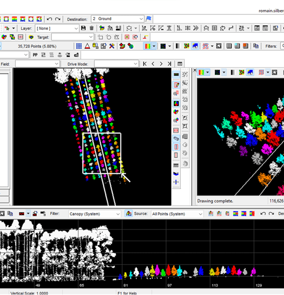
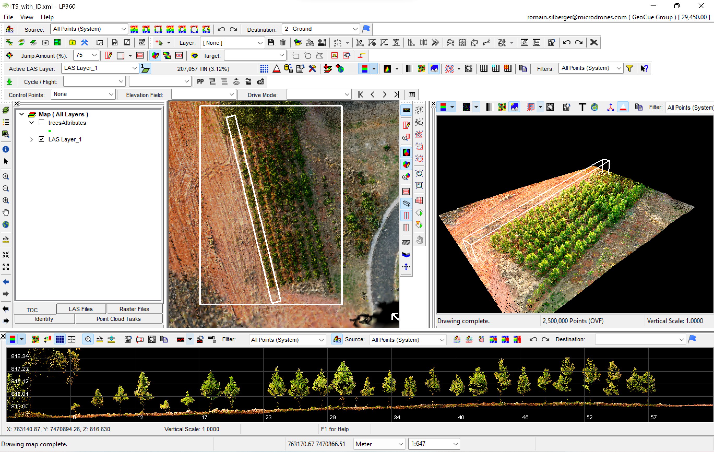
The data acquisition, in general, takes 30-minute flight capturing around 40 hectares. Normally, for 1 minute of flight, it will take 1 minute of processing. After creating a georeferenced colorized point cloud with the software LP360 from GeoCue, it was possible to apply the ITS algorithm (Individual Tree Segmentation). Then, individual data per tree like height and crown surface could be derived. All data could be easily export into excel for statistic purpose. For this study, 177 pine trees were counted, with an average of 3,6 m height and 2,36 m2 crown surface. In Brazil, the foresters can acquire or rent an equipment, but also contract a third party to capture and process the data on their behalf.